Shenzhen–Zhongshan Cross-Sea MESH Test
The 7 August 2026 air-to-ground cross-sea report covers omnidirectional and directional antennas, a three-node single-hop setup and a two-hop setup. All eight pages of field photos, link screenshots and test notes are displayed below.
The report lists a 30 km target, a 28.6 km map measurement and an approximately 28.3 km link display. Its antenna list says 4 dBi while a later passage says 5 dBi; both source readings are retained pending clarification. Referenced video files can be added when supplied.
View the original text layer
Text extracted from the original PDF. For table order and labels inside figures, refer to the page scan above. The source language is preserved.
20260807 货架产品深圳对中山测试情况记录
1、8 月 7 日深圳到中山空地场景隔海测试
1.1 测试目的
基于空对地场景,测试 30 公里海面场景图传能力。
1.2 测试环境
测试时间:2026-08-07
测试场景:一边节点 1 无人机升空 4m,同时节点 2 地面用三角架高 1.6m,采用
全向以及定向天线测试 28 公里的图传通信能力,无人机端位于中山市翠亨新区
南朗街道环岛路附近,节点 3 接收端位于深圳市南山区蛇口赤湾左炮台路, 海拔
120 米左右,两地点隔海 28 公里左右,无遮挡。
硬件设备:自研货架 3 套(无人机端 2 套(一套飞无人机测试,一套位于地面端
监测),图传地面接收端 1 套) ,调试机2 台,天线 6 根(4 根 1.4G 全向天线
(4dBi),2 根定向天线(14dBi)),测试无人机一套。
相关软件:谷歌上网浏览器,VLC 视频软件
1.3 测试过程
(1)先用全向 1.4G 天线测试图传性能, 同时无人机端地面架一辆设备用于
监测无人机处的电台情况,再用定向高增益天线重复该测试流程。

1.4 测试结果
1)测试场景:
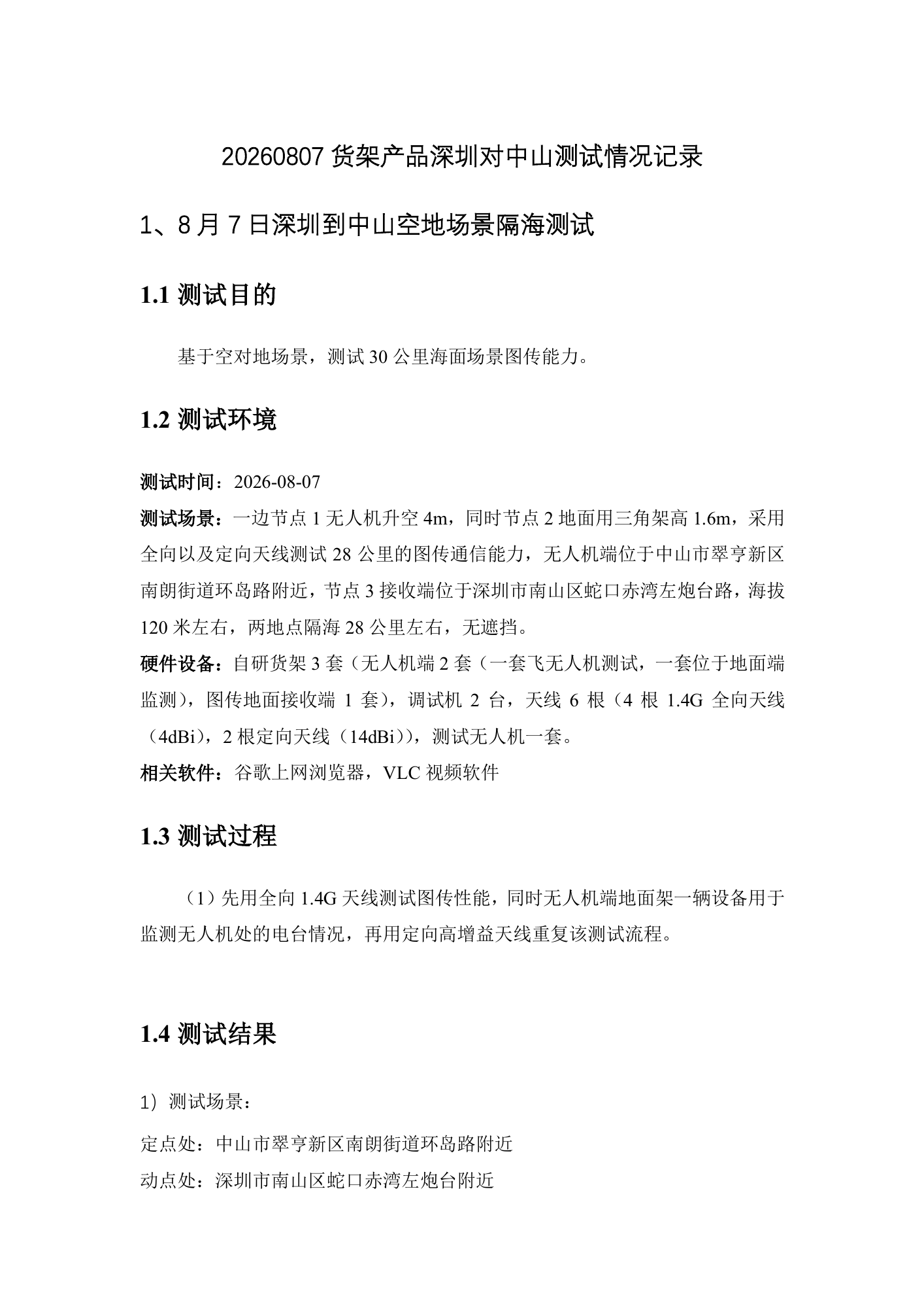
定点处:中山市翠亨新区南朗街道环岛路附近
动点处:深圳市南山区蛇口赤湾左炮台附近
View the original text layer
Text extracted from the original PDF. For table order and labels inside figures, refer to the page scan above. The source language is preserved.
两点距离:28.6KM(某地图软件测距功能)


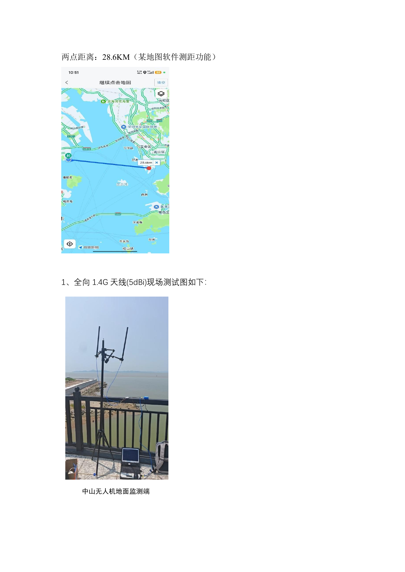
1、全向 1.4G 天线(5dBi)现场测试图如下:

中山无人机地面监测端
View the original text layer
Text extracted from the original PDF. For table order and labels inside figures, refer to the page scan above. The source language is preserved.
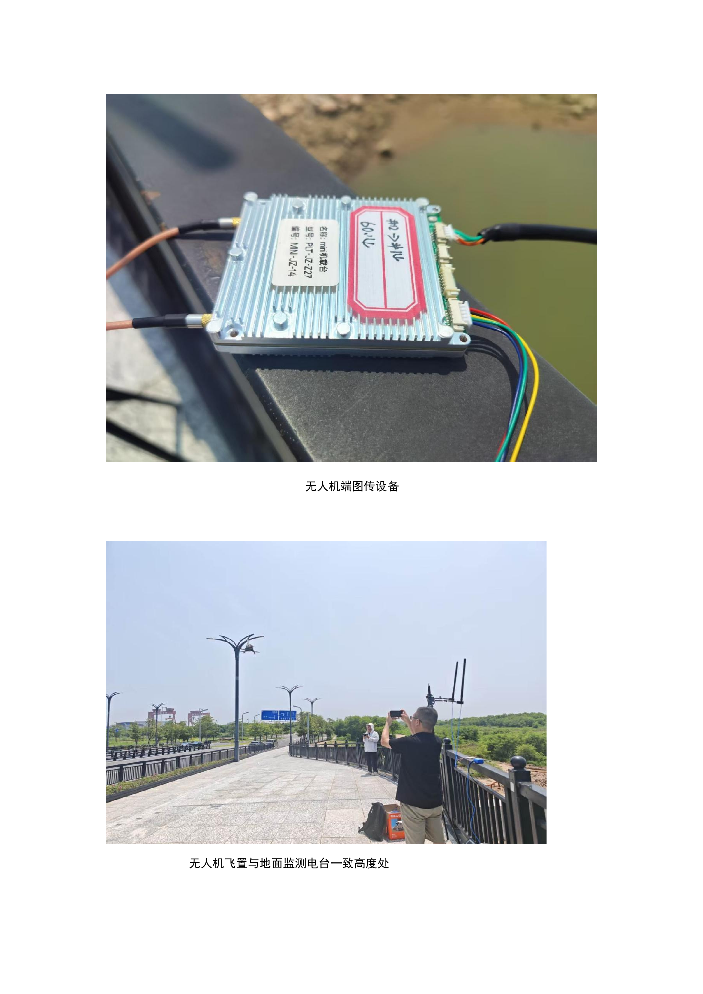
无人机端图传设备


无人机飞置与地面监测电台一致高度处
View the original text layer
Text extracted from the original PDF. For table order and labels inside figures, refer to the page scan above. The source language is preserved.
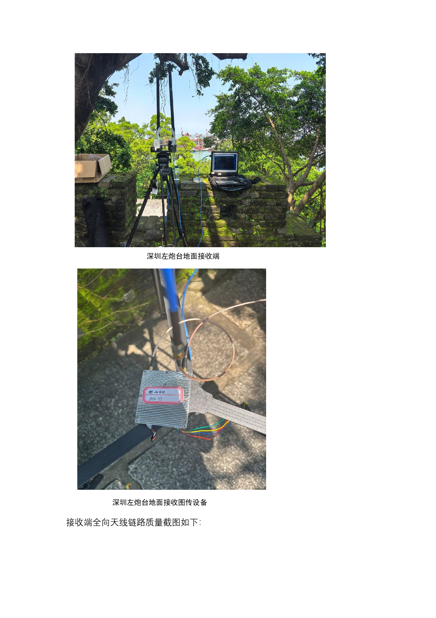
深圳左炮台地面接收端

深圳左炮台地面接收图传设备
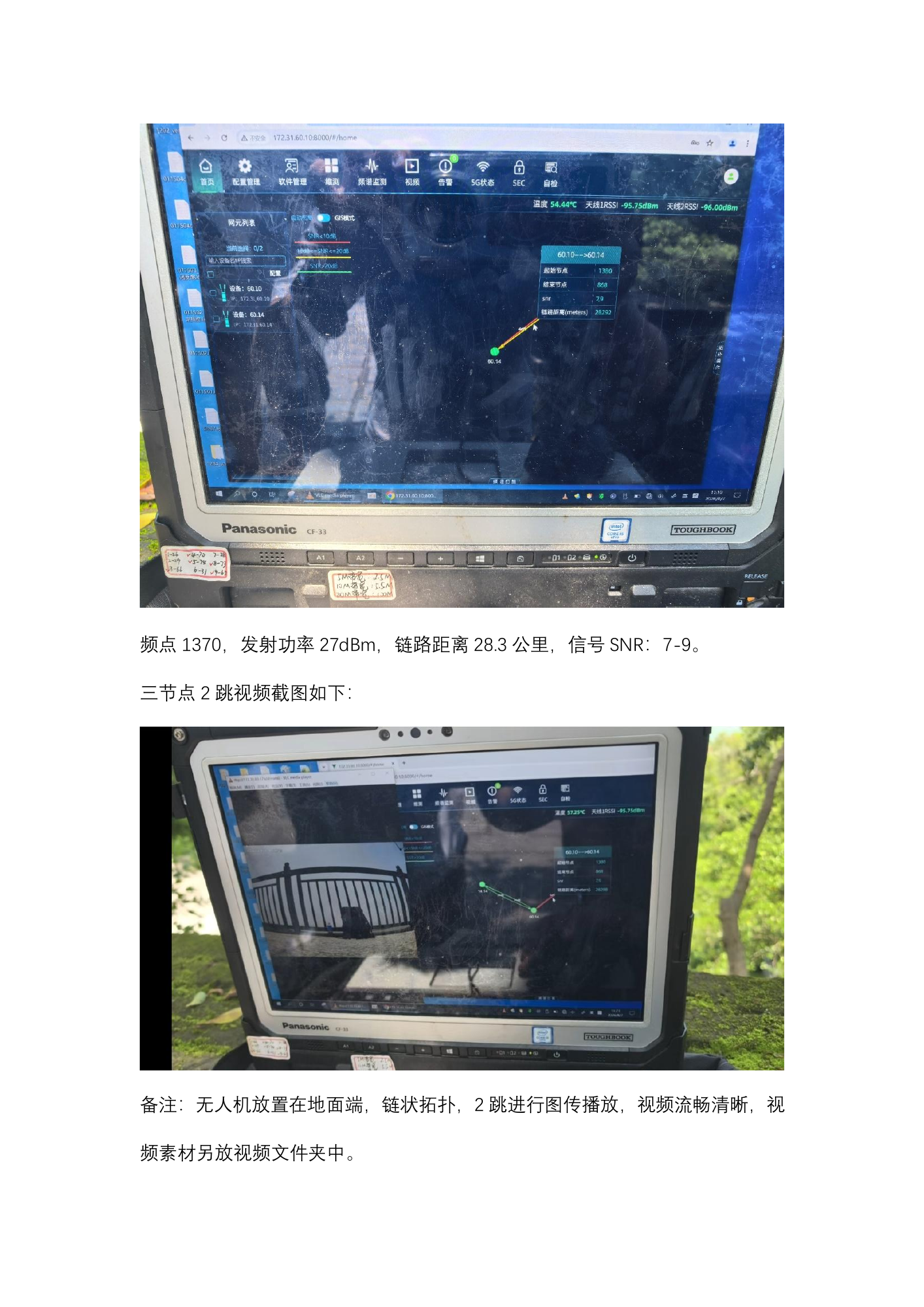
接收端全向天线链路质量截图如下:
View the original text layer
Text extracted from the original PDF. For table order and labels inside figures, refer to the page scan above. The source language is preserved.
频点 1370,发射功率 27dBm,链路距离 28.3 公里,信号 SNR:7-9。
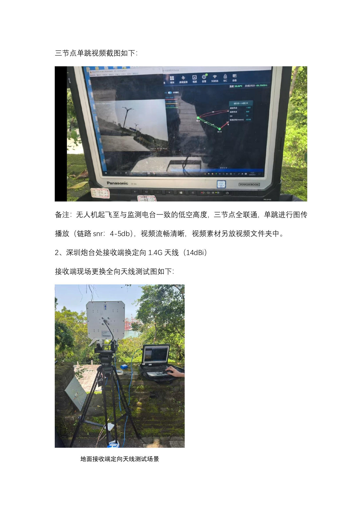
三节点 2 跳视频截图如下:

备注:无人机放置在地面端,链状拓扑,2 跳进行图传播放,视频流畅清晰,视
频素材另放视频文件夹中。
View the original text layer
Text extracted from the original PDF. For table order and labels inside figures, refer to the page scan above. The source language is preserved.
三节点单跳视频截图如下:

备注: 无人机起飞至与监测电台一致的低空高度, 三节点全联通, 单跳进行图传
播放(链路 snr:4-5db) ,视频流畅清晰,视频素材另放视频文件夹中。
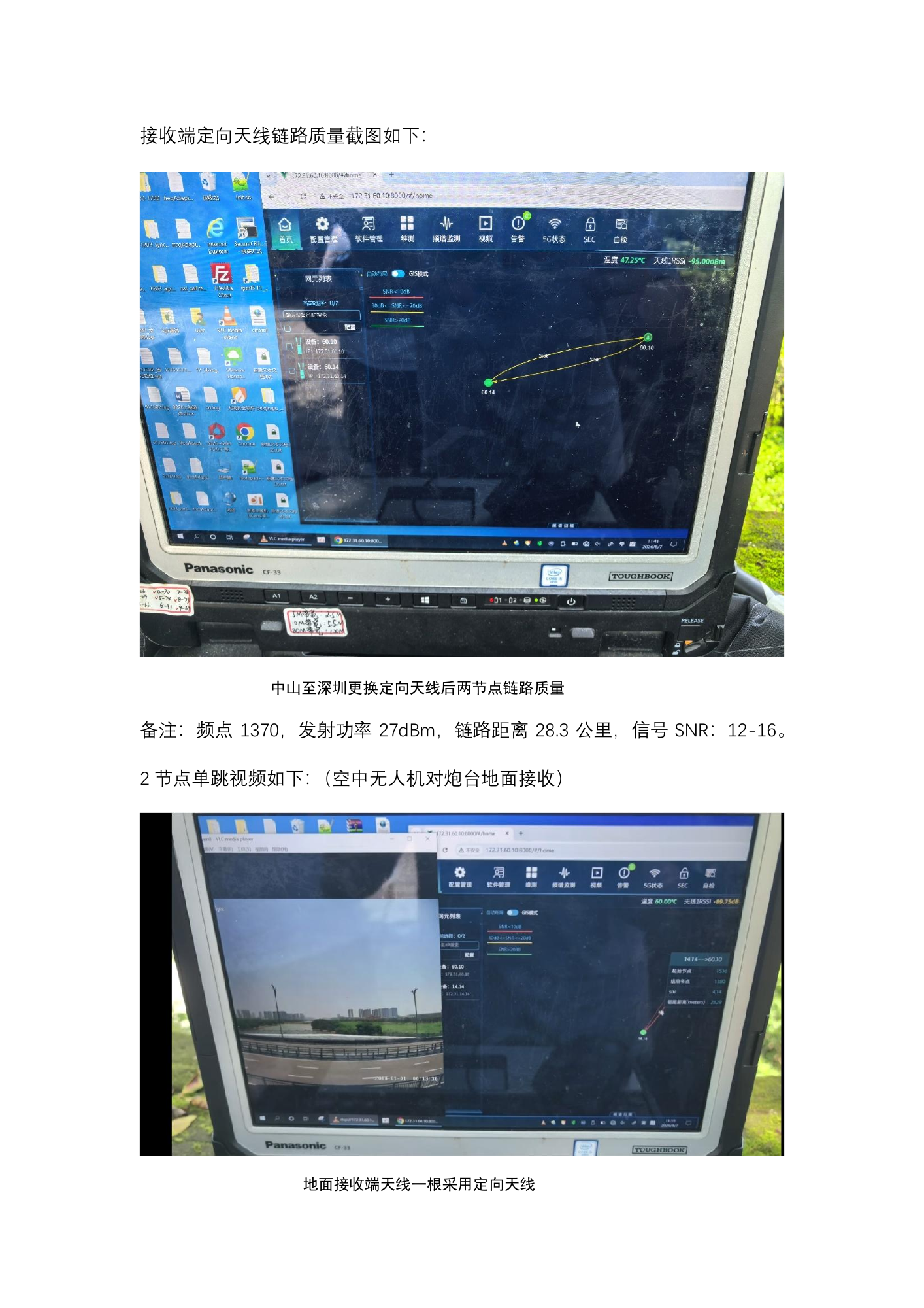
2、深圳炮台处接收端换定向 1.4G 天线(14dBi)
接收端现场更换全向天线测试图如下:

地面接收端定向天线测试场景
View the original text layer
Text extracted from the original PDF. For table order and labels inside figures, refer to the page scan above. The source language is preserved.
接收端定向天线链路质量截图如下:

中山至深圳更换定向天线后两节点链路质量
备注:频点 1370,发射功率 27dBm,链路距离 28.3 公里,信号 SNR:12-16。
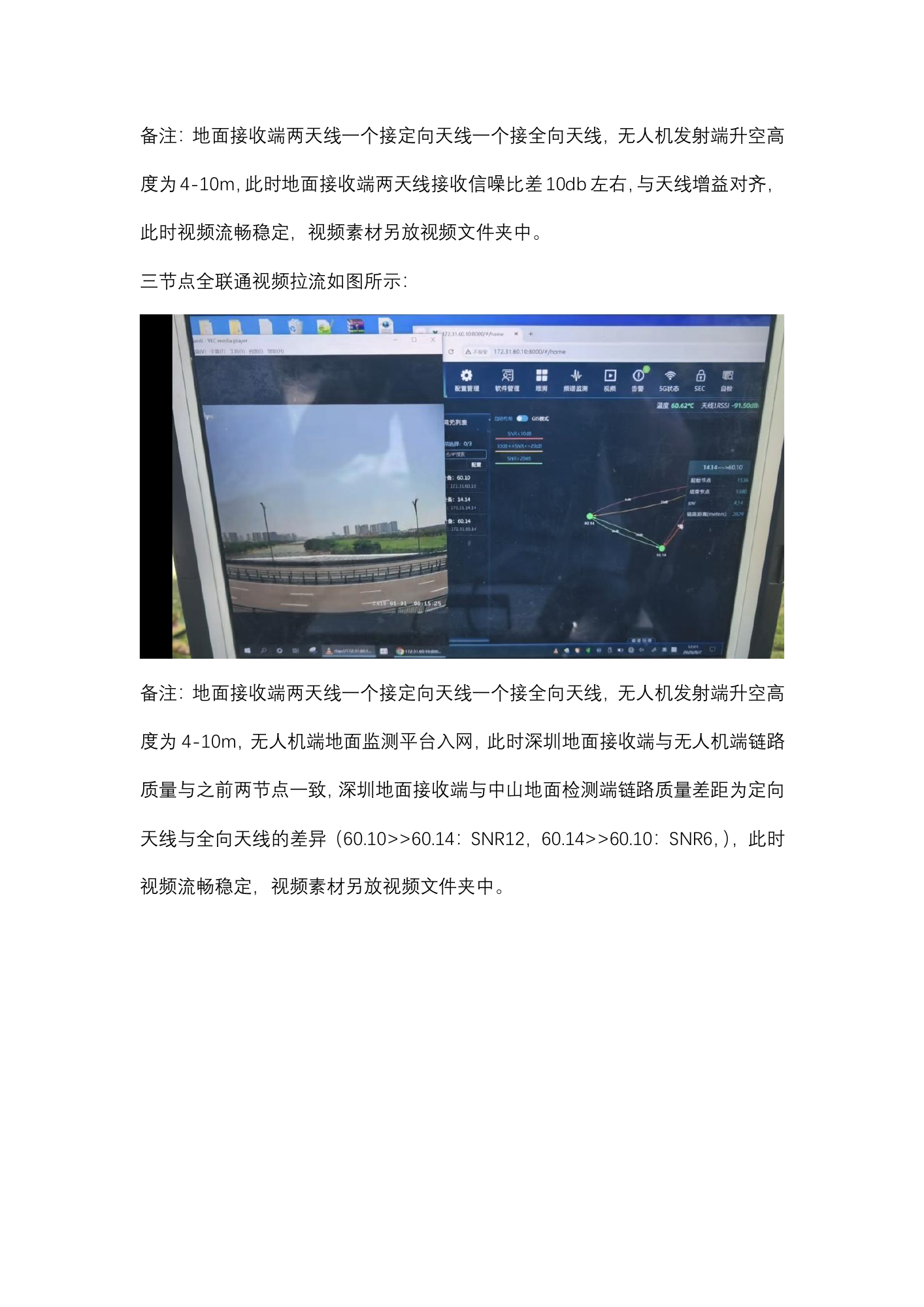
2 节点单跳视频如下: (空中无人机对炮台地面接收)

地面接收端天线一根采用定向天线
View the original text layer
Text extracted from the original PDF. For table order and labels inside figures, refer to the page scan above. The source language is preserved.
备注: 地面接收端两天线一个接定向天线一个接全向天线, 无人机发射端升空高
度为 4-10m, 此时地面接收端两天线接收信噪比差10db 左右, 与天线增益对齐,
此时视频流畅稳定,视频素材另放视频文件夹中。
三节点全联通视频拉流如图所示:

备注: 地面接收端两天线一个接定向天线一个接全向天线, 无人机发射端升空高
度为 4-10m,无人机端地面监测平台入网,此时深圳地面接收端与无人机端链路
质量与之前两节点一致, 深圳地面接收端与中山地面检测端链路质量差距为定向
天线与全向天线的差异 (60.10>>60.14:SNR12,60.14>>60.10:SNR6, ) , 此时
视频流畅稳定,视频素材另放视频文件夹中。