Daya Bay Approximately 20 km Air-to-Ground Video Link Test
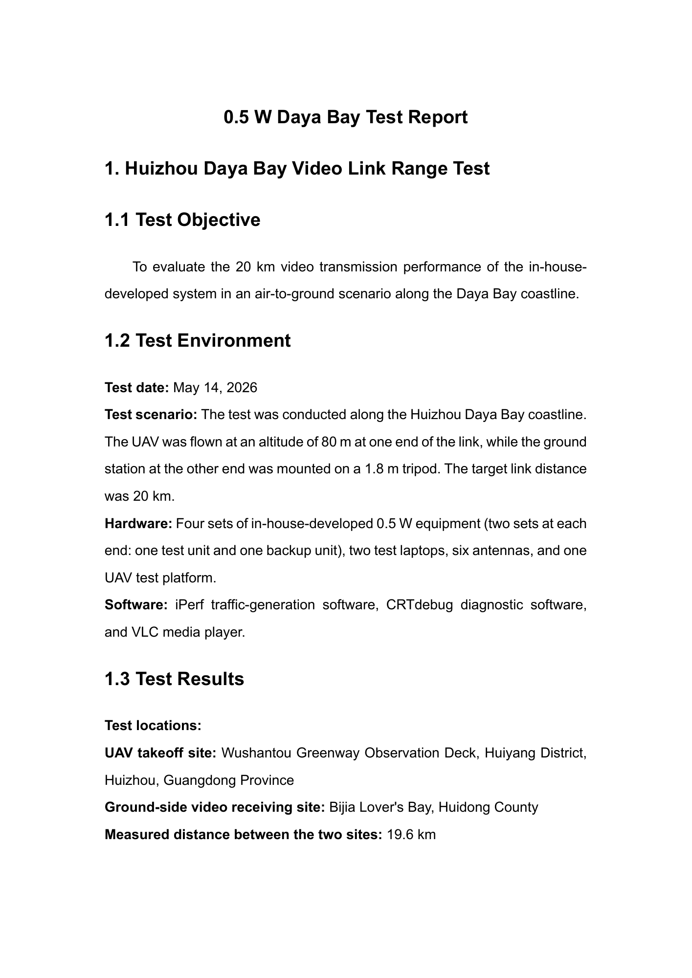
The supplied English PDF records an air-to-ground test at Daya Bay on 14 May 2026. Its target was 20 km and the measured separation between locations was 19.6 km. It records an aircraft altitude of 80 m and a ground tripod height of 1.8 m. All three pages are shown below.
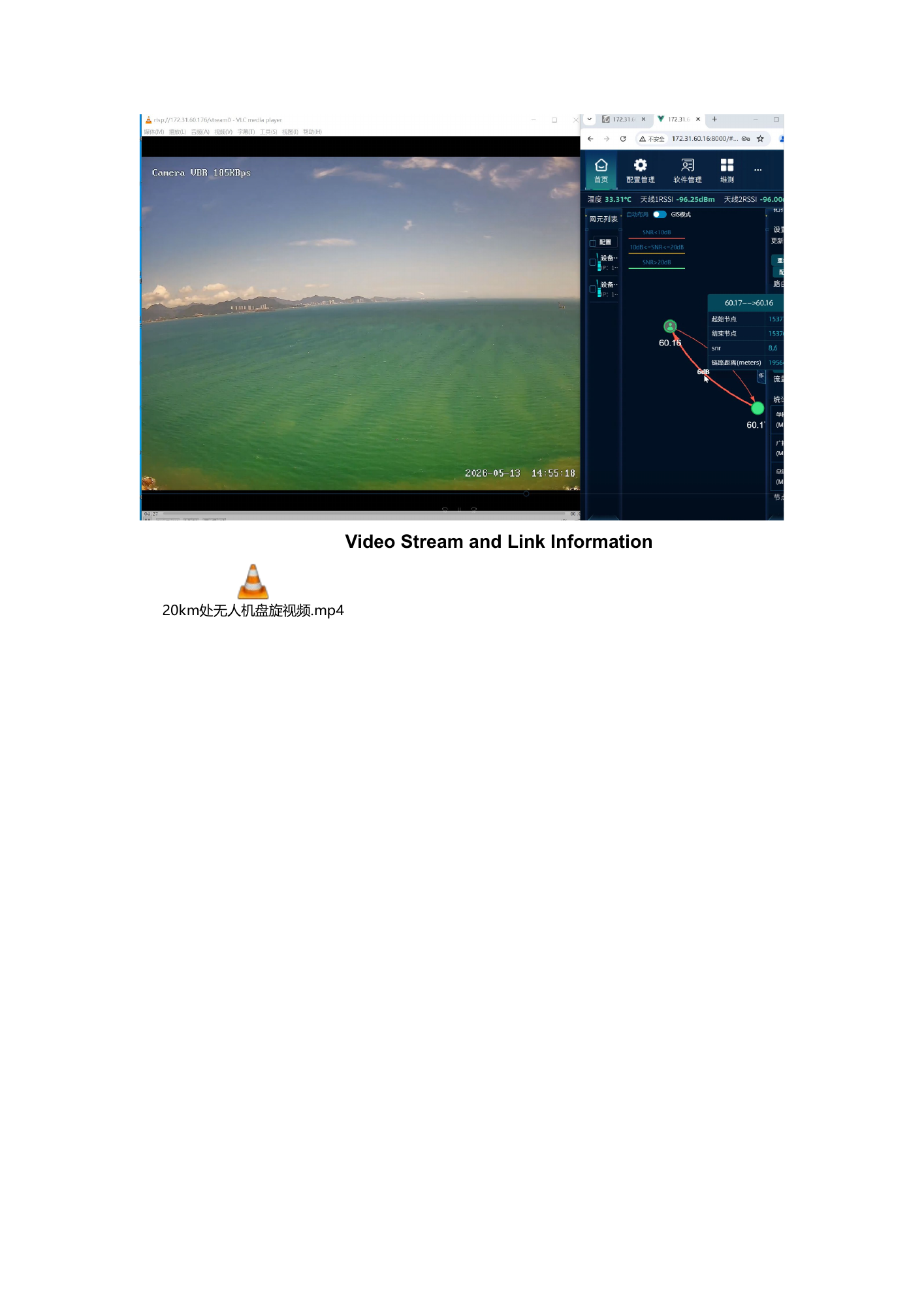
This PDF is the current source version. It includes video frames and a video filename, but no separately verified, playable video has yet been supplied to this site.
View the original text layer
Text extracted from the original PDF. For table order and labels inside figures, refer to the page scan above. The source language is preserved.
0.5 W Daya Bay Test Report
1. Huizhou Daya Bay Video Link Range Test
1.1 Test Objective
To evaluate the 20 km video transmission performance of the in- house-
developed system in an air-to-ground scenario along the Daya Bay coastline.
1.2 Test Environment
Test date: May 14, 2026
Test scenario: The test was conducted along the Huizhou Daya Bay coastline.
The UAV was flown at an altitude of 80 m at one end of the link, while the ground
station at the other end was mounted on a 1.8 m tripod. The target link distance
was 20 km.
Hardware: Four sets of in-house-developed 0.5 W equipment (two sets at each
end: one test unit and one backup unit), two test laptops, six antennas, and one
UAV test platform.
Software: iPerf traffic -generation software, CRTdebug diagnostic software,
and VLC media player.
1.3 Test Results
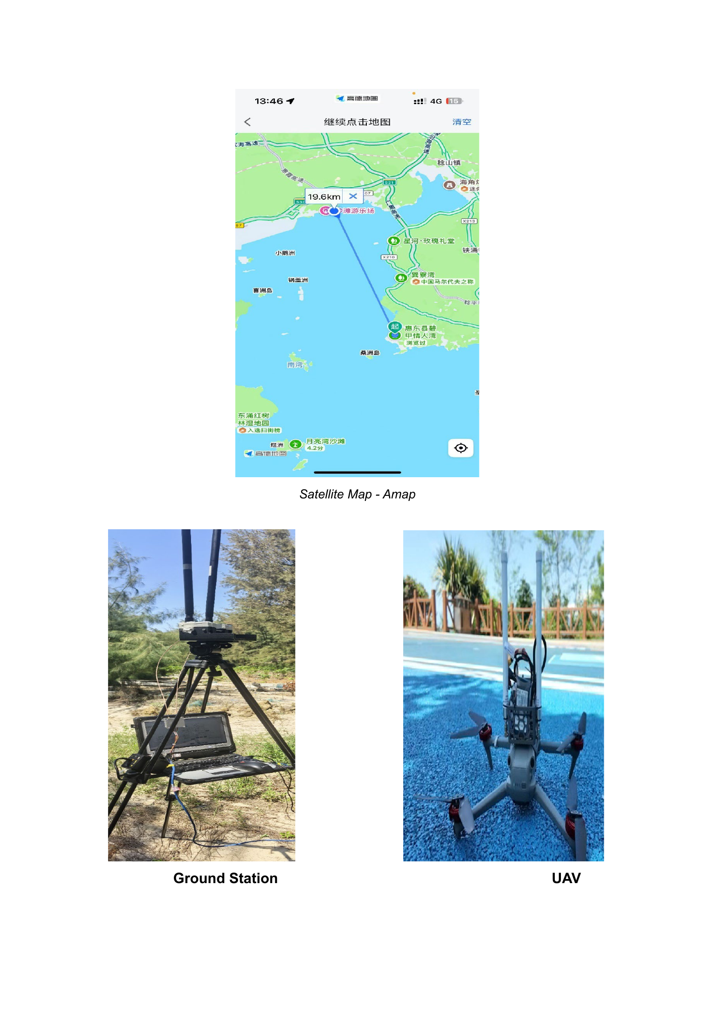
Test locations:
UAV takeoff site: Wushantou Greenway Observation Deck, Huiyang District,
Huizhou, Guangdong Province
Ground-side video receiving site: Bijia Lover's Bay, Huidong County
Measured distance between the two sites: 19.6 km
View the original text layer
Text extracted from the original PDF. For table order and labels inside figures, refer to the page scan above. The source language is preserved.
Satellite Map - Amap

Ground Station                                      UAV
View the original text layer
Text extracted from the original PDF. For table order and labels inside figures, refer to the page scan above. The source language is preserved.
Video Stream and Link Information
20km处无人机盘旋视频.mp4